Archive for January, 2009
White Rock and Bald Mountain – New York
The Taconic Ridge lies along the border between New York and Vermont/Massachusetts, and includes a number of NY cheeseburger summits. Along the top of the ridge, the Taconic Crest Trail stretches for 35 miles, and crosses many of these summits. The Taconic Hiking Club offers a number of patches related to completion of this trail. One is for completion of all sections, and another is for completion of the biannual “End-to-End” hike, which actually only covers about 27-29 miles, but all in one day. I’ve done both of those, but completely without cheeseburgers. The third patch can be earned by completing all sections in winter, and that’s what I’m working toward now.
Today (01/31/09), I led a hike for the Schenectady Chapter of the Adirondack Mountain Club (ADK) , where 6 of us completed a 6-7 mile section of the trail. In the process, I logged 2 new cheeseburger summits.
We dropped a car at the Prosser Hollow Access trailhead in North Petersburg, which we would later descend to off the ridge. Then we drove south and uphill to Petersburg Pass, where NY2 crosses the ridge. From there, we would proceed north along the ridge to the Prosser Hollow Trail. and descend to the pre-positioned car. The hike was approximately 6.75 miles, with cumulative elevation gain of 1378′, and cumulative loss of 2479′. Downhill all the way. Yeah, right.
Getting started from the Petersburg Pass trailhead proved challenging, with temps hovering around +10F and a biting wind. It was hard enough just gearing up. The delay proved fortuitous in the end, since an Albany ADK trip over the same route got started just ahead of us and left us a nicely broken trail for the first mile or so. After we caught up with them, we all did our part.
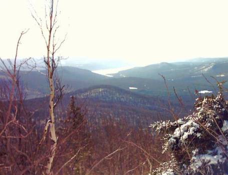
Along the way, there are several very nice views to the west from open meadows along the ridge. This one is from White Rock, the first cheeseburger summit of the day.
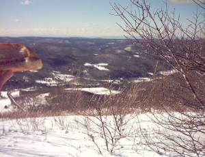
With the wind, we didn’t tarry long there. Today, the real scenery was in the woods anyway. The trees were coated with several inches of new snow. In places, they were so bent over and plastered sideways with windblown snow that neither the trail markers nor the trail were visible. Route finding became a bit of a challenge at times for the person in the lead.
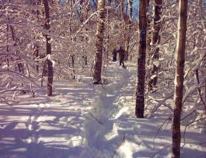
The snow was deep, and somewhere within its depth was hidden an icy crust. We rotated turns up front breaking trail, and never knew from one step to the next whether we’d break through the crust or not. It made for a much tougher trip than the mileage would indicate. About mid-way in our hike along the ridge, we stopped at the famous Snow Hole, a deep fissure in the rocks that often contains snow even in the middle of summer. It’s fun to crawl down in there on a hot day, but today would have been a little treacherous. (ASIDE: The USGS has had this wrong for years, as “The Snow Hole” is clearly not the 698-meter summit at the coordinates listed. It’s neither a summit nor at that location. More on this in a future post)
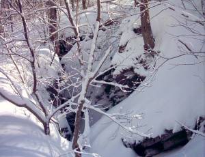
Soon after The Snow Hole, we came to Bald Mountain, the second cheeseburger summit of the day.
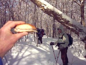
We stopped for lunch at a relatively wind-free spot along the ridge, and then descended to the junction with the Prosser Hollow Trail, where we left the Albany group as they continued north along the ridge. The trip down to the car went quickly, even though we were now breaking our own trail all the way. Then we all piled in, drove back to Petersburg Pass to retrieve the other car, and headed home after a tiring but satisfying day.
Hadley Mountain, Saratoga County, NY
Hadley Mountain (2675 ft) is a small mountain in northern Saratoga County, NY. The 1.8-mile trail to its summit and fire tower climbs 1525 ft from the trailhead, making for a short stiff climb. The first mile is especially relentless, climbing over 1000 ft of that total with few breaks.

Somewhat on the spur of the moment, I climbed Hadley today on a well-packed trail, taking about 1:15 to the summit. Along the way, there are wonderful views to the south toward Great Sacandaga Lake from some rock ledges.
Just below the summit is the former fire observer’s cabin, its sheltered front porch a common refuge on windier days.
Today, there was very little wind and a brilliant blue sky. Views to the north toward the Adirondack High Peaks were outstanding.
On the summit, I did my part for the Summit Cheeseburger Project. On the drive up, I remembered to stop in Corinth at a Stewart’s Shop and picked up a cheeseburger. On the summit, with temps in the 20s, it was barely lukewarm, but it served the purpose. Hadley is only the third of 3,397 New York summits to be logged as completed.
The trip back to the car took less than 45 minutes. It’s amazing how much easier a rocky rooty trail can be in the winter when it’s smoothly packed snow.
Rich aka adk46r2783
Bald Rock in Alabama
January 18, 2009; Bald Rock in Alabama
I took a drive down to Mount Cheaha State Park today to eat a cheeseburger on top of Alabama’s highest point, Cheaha Mountain, and then another at Bald Rock, just to the north-northeast at 2,326 feet according to the topo maps. Bald Rock is the second highest point in Cleburne County. I have made the quarter mile walk from the parking lot for the boardwalk, which was built all the way to the summit, once before and again I found myself quickly exiting the boardwalk to walk the trail which runs alongside. Bald Rock Lodge can be seen just to the right as you enter the parking lot for the boardwalk. The lodge was originally built by the Civilian Conservation Corps (CCC) and served as the park Hotel. It was renovated in 2002/3 and is now available for large group rental. The views at this summit were much better than experienced earlier this morning. As I ate my cheeseburger here, I snapped a photo of the pleasing view and watched buzzards and hawks glide right in front of me in the windy conditions. Completely surrounded by the Talladega National Forest, this is Alabama’s oldest continuously operating state park, first opening in 1933. A nominal fee of $1 is required at the park entrance.
A dandy view from Bald Rock:

A shot of the disappearing cheeseburger at the rock outcroppings on the summit:

Chimney Peak in Alabama
January 18, 2009; Chimney Peak in Alabama
Continuing my drive around the Alabama country side today, I stopped at Chimney Peak to eat a cheeseburger on top of Calhoun County’s 12th highest point at 1,716 feet. Chimney Peak can be reached from Mountain Street in Jacksonville, Alabama, which becomes Chimney Peak Tower Road. There are two pull-offs available near the summit which gives visitors a good view of the valley below. A retired fire tower still stands atop the summit alongside the all too common communications towers. I tried a different brand of cheeseburger here, but I have to figure out some other way. A cold fast food cheeseburger isn’t the tastiest of cheeseburgers. I think the cheeseburger itself, plus the logistics need to be better. I shall endeavor to strive for improvement.
A shot of the disappearing cheeseburger at the fire tower on the summit:

The view to the northeast:

The view to the west, overlooking Jacksonville:

Cheaha Mountain in Alabama
January 18, 2009; Cheaha Mountain in Alabama
I took a drive down to Mount Cheaha State Park today to eat a cheeseburger on top of Alabama’s highest point, Cheaha Mountain at 2,407 feet according to the information sign, and 2,405 feet according to the topo maps. I have been here several times, and always enjoy climbing up to the top of the rock observation tower to see what I can see. Today, the view was obscured by cloudy conditions, although it did dissipate soon after I left the top. I had a look at the USGS benchmarks here once again and noted the water tanks and communication towers on top. Completely surrounded by the Talladega National Forest, this is Alabama’s oldest continuously operating state park, first opening in 1933. Much of the development and construction was done by the Civilian Conservation Corps (CCC), including the rock observation tower on the summit. No hike is necessary to reach this summit; you can drive right to the parking lot for the observation tower for the nominal fee of $1 at the park entrance.
David showing off his cheeseburger inside the observation tower on the summit:

Another shot of the disappearing cheeseburger at the information sign:

The rock observation tower on the summit, taken from the walkway:

One of the many communication towers now adorning the summit:

First Sumitted Cheeseburger in Southeast – Flagpole Mountain, AL
Woot! First Summited in the Cherokee County, Alabama, and the Southeast!
Continue Reading January 13, 2009 at 3:30 pm Jamie 5 comments

